Greenway and Trail Planning
 Overview
Heritage Conservancy and others committed to conservation have succeeded in preserving thousands of individual parcels of land that provide valuable wildlife habitat, riparian stream buffers, scenic vistas, and healthy recreational opportunities, among many other benefits. However, in some cases, their value is limited because they exist in isolation. One way to mitigate this problem is to connect these open spaces by a network of natural corridors—a greenway.
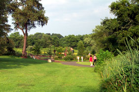
Connecting core areas through trails is also one of the best ways we know to engage the public with their natural environment. Trails allow people to experience open spaces and the wonders they hold first-hand, which almost inevitably leads to a desire to see those areas preserved and protected.
With expertise in geospatial mapping, landscape design, land use planning, conservation biology, public engagement and government relations, Heritage Conservancy is able to form partnerships with the myriad of organizations and individuals that are inevitably involved with forming a greenway or planning a trail.
Methods
Heritage Conservancy analyzes the areas that could potentially form part of a greenway or trail. This analysis includes gathering and assessing information on animal and plant life as well as historic resources, topography, geology, and soil types that are found there. We also convene or participate in meetings and work sessions among the many constituents who may have a stake in the plans, to gather information about their conservation and recreation needs and desires. Data analyses are combined with learnings gained from meetings with municipal officials and the public to inform a greenway and/or trail plan. Heritage Conservancy can also manage implementation of these plans.
 Project Highlight
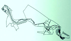
Heritage Conservancy supervised a team of consultants to prepare a trail master plan for a 2.5-mile segment of the historic Tookany Creek Parkway in Cheltenham Township, Montgomery County. The process began with development of a GIS base map on which was layered the field inventory and analysis of existing natural, historic and man-made resources. Heritage Conservancy evaluated the health of the immediate riparian buffer and its impact on the entire Tookany Creek, making recommendations for improvement. The resulting Tookany Creek Trail Master Plan identifies specifics of the trail, such as material composition, width, local areas for streambank restoration, parking, pedestrian circulation system, construction phasing, and the trail operation and management plan.
Read about Heritage Conservancy’s work in planning the Playwicki Farm Trails in Bucks County.